Chapter 8: Public Lands
From the nation’s beginning, many Americans believed the country’s future was in agriculture. Public officials articulated a continuing policy that would build a nation of “yeoman farmers”—small farm operators who owned their own land. Initially, the policy seemed logical, given that agriculture employed the most people and served as the bedrock of the nation’s economy. Thomas Jefferson was a leading proponent of the policy, but many others believed land ownership was the key to maintaining American democracy.[i]
Even prior to drafting the Constitution, American governments dealt with land issues. Seven of the original states ceded to the new frderal government some 233.4 million acres of land westward to the Mississippi River.[ii] Through purchase, conquest and treaty, the United States acquired an additional billion acres of public domain. Nearly two billion acres of land in 32 states have been part of the public domain at one time or another.[iii]
Early settlers used “metes and bounds” as a means of determining land boundaries. As an example of this method, a deed might say that the farmer’s land might begin at “the big oak tree” and proceed along a straight line south to a “large rock” and then east to the “creek” and then follow the creek north back to the “big oak tree.” The shapes of the lands were not necessarily square, but based on natural features. This method of measure worked adequately in the limited lands of the smaller eastern states, but it was impractical for measuring out the vast public lands to the west.
The most lasting law passed under the Articles of Confederation was the Land Ordinance of 1785 that called for all of the nation’s lands to the West to be surveyed into townships six miles square with each divided into 36 sections of 640 acres per section.[iv] A section is one square mile. Townships ran from baselines and principal meridians with each township having a “range number” that indicate the east-west row from the principal meridian and a “township number” that denotes the number of the row north or south from the baseline. Sections also are numbered—beginning from the northeastern corner of a township, moving west to the end of the row and then, on the second row, moving east, then west again, to finally end with Section 36 in the southeast corner of the township. Each section could be divided into halves, quarters, or “quarter-quarters.”
The system makes it very easy to identify a specific location and, of course, was essential when the federal government was attempting to give away as much of its land as possible in the 19th century. Each tract of land opened for homestead entry was designated by section, township and range. This method, along with a deed-filing system, made it unlikely that two people mistakenly would believe they owned the same land, for example.[v]
The federal government initially tried to sell its lands, but it wanted the land to go in small parcels to promote establishment of small farms. One method, used after the Revolutionary War, the War of 1812, and the Mexican War, was to give land scrip or a land warrant to each veteran. He could then go out into the public domain, find an unoccupied 40 or 160-acre tract and trade in his “scrip” for the land at the nearest federal land office. In some cases, modest payment per acre was also required. In 1855, the act was extended to all veterans who previously had not claimed at least 160 acres under earlier acts.
Records show that more than 68 million acres of federal land went to holders of veterans’ scrip. More than 425,000 veterans received scrip, but not all of them wished to take up a career in farming. Consequently, a market in land scrip developed and, until property was claimed utilizing the scrip, anyone could obtain it. Speculators bought scrip from a number of veterans, brought together thousands of individually issued scrip, made the claim, and withdrew huge amounts of land from the public domain for little cost. The abuses allowed for huge profits for such companies and, while it did serve the policy of getting rid of as much federal land as possible, it did not necessarily encourage small farms.[vi]
Still, much land remained and Congress wished to put much of it into private ownership. Congress passed the Preemption Act of 1841 that allowed for sale of up to 160 acres to anyone as long as they paid $1.25 per acre. Initially, the act was successful. In many years in the following decade, most government revenue came, not from taxes, but from proceeds of public land sales.
As early as 1848, the “Free Soil party” was formed with the platform of giving government land for free to landless farmers. The proposal gained popularity, particularly in the North and Midwest. Members of Congress from those regions tried unsuccessfully to pass laws to give farmers free land. Such laws did not pass until the South seceded at the beginning of the Civil War and Southern opposition, thus, disappeared.
In the spring of 1862, Congress passed the Homestead Act. A person could get up to 160 acres of federal land. The individual had to be the head of a family or 21 years old or older, a citizen of the United States or intending to be a citizen, and not the owner of more than 160 acres of land in the United States.[vii] A further requirement indicated the wartime passage of the act: the individual could not have “taken up arms against the United States.” The individual had to live on the land as his/her sole residence, grow crops on it and “improve” it for five years at which point, the individual gained a patent from the United States which conveyed full title and unrestricted ownership. Only one homestead entry was allowed per person.
During the same week that the Homestead Act of 1862 passed, Congress also passed the first Pacific Railway Act, using the extensive public lands as a means of encouraging construction of railroads. In exchange for building the transcontinental railroad, the privately-owned railroad companies gainec from the federal government the odd-numbered sections each side of the tracks for a distance of 20 miles on each side. (The federal government kept the even-numbered “checkerboard” sections). The railroad land grants passed millions of acres into railroad company hands. In Wyoming alone, the Union Pacific Railroad received 4,582,520 acres. As years passed, the railroad sold some of these lands, but even into the 21st century, the railroad remained the largest private landowner in Wyoming as a result of the federal gifts of land made in the 1860s.
Many railroads, including the Union Pacific, tried to sell some of their land-grant lands to farmers and settlers. Sales went well in fertile areas, but not well across most of arid Wyoming.[viii] Some promoters used unique arguments to push land sales. “Rain follows the plow,” one argument went. “While the dry lands around you might look bad now,” it said, “but once the land is ‘loosened’ by plowing, precipitation will be released and rain will start falling in the area.” Obviously, the argument was scientifically suspect, but later versions were even more dubious. For instance, “rain follows the rails”—in which the promoter, pointed out that where railroads ran in the east, it was always lush and green. Thus, rain must follow the rails. Similar promotions replaced “rails” with “trees.”
Most members of Congress recognized the flaws in “rain follows the trees.” Nonetheless, in 1873, Congress passed the Timber Culture Act out of concern for the absence of trees in the Great Plains. The act allowed a settler to receive 160 more acres of federal land if he/she agreed to plant trees on at least 40 acres of that land. (Later, the acreage was reduced to five acres in trees). To gain the land patent after eight years, the homesteader had to demonstrate he/she kept the trees surviving “at least six” of those years.[ix] Historians point out that the requirements of the act were frequently violated. The act was repealed in 1891.
With the 320 acres available under the existing acts, farmers could succeed on homesteads in the more fertile valleys of the West. The land area was too small for success in much of Wyoming where precipitation was sparse. Consequently, Congress passed another land measure in 1877 titled the “Desert Land Act.” The word “desert” was defined as lands where agriculture was impossible without irrigation. Much of Wyoming is “desert” under this definition. The act increased the size of the land a homesteader could claim to 640 acres in “desert areas.” The homesteader had to “bring water” to the land within three years of settling on the tract. Because of the vague statement, “bringing water to the land” could be construed very broadly. Was a tiny canal sufficient? How about a scratched line in the dirt on which a bucket of water was poured?
At about the same time, John Wesley Powell, after another of his western expeditions, sent a report to Congress on the condition of Western lands. Powell’s “Arid Lands report” pointed out that most of the West lacked sufficient rainfall for successful crop agriculture. To farm successfully, the land had to be in close proximity to a flowing river or stream, Powell wrote. Even then, the land was of such poor quality that to sustain a family of four, far more than 160 acres would be required. In fact, as Powell saw it, to succeed in crop agriculture in the West, a family of four had to have at least 2,560 acres of land and the land had to lay along river drainages. Less than four percent of the West, Powell pointed out, would ever be suitable for agriculture. (His estimate was remarkably prescient—about four percent of all lands in the West are under cultivation). Congress failed to address Powell’s suggestions, apparently reasoning that the recent passage of the Desert Land Act would be sufficient to encourage settlement in the region.
Public lands—vast open ranges where ranchers could graze cattle without having to pay for grass, water, or taxes—made it possible for the huge cattle companies to thrive on the ranges of Wyoming in the 1870s and early 1880s. The Desert Land Act presaged their decline because small ranchers, willing to try to subsist on 640 acres, could file for a Desert Land claim in the middle of a prime pasture, perhaps next to a flowing stream. He could then use the newly invented and reasonably cheap barbed wire to keep the livestock of others off of his homestead claim. Combined with the increasing numbers of open range outfits, homesteading made it more and more difficult for the big operations to thrive without having to lay out a large investment or attempt to gain ownership over what had been public land.
While the act did bring more settlers to the arid lands of much of Wyoming, it also encouraged fraud. Owners of big open-range cattle companies were known to direct employee-cowboys to make “dummy filings”—file in their names but with the intent of turning the land back over to the company. That way, the open-range companies could counter threats of losing access to prime public lands that, all along, they were able to use at no cost.
Operators of big ranches also gradually responded to competition for good range by illegally fencing vast sections of the public domain. Initially, the federal government did not act against such law-breaking. Finally, Public Land Commissioner William A. J. Sparks recognized the extensive fencing violations, but initially sought a compromise. He asked cattle ranchers in Wyoming in 1879 what they would be willing to pay to own the land and, thus, control it. The answer was “nothing.”[x] The ranchers believed they were “owed” free use of the federally-owned open range lands. They did not want to own the property because they would have to pay taxes on it. Why own it when you can have the federal government give you use of it for free?
The land office itself lacked sufficient manpower to enforce open range rules. Therefore, Sparks asked for military help to take down many of the offending fences. Many affected by Sparks’ action were prominent ranchers with significant political connections. Among those challenged over illegal fencing were Wyoming politicians Francis E. Warren, Joseph M. Carey, and in later years, John B. Kendrick. The federal action of trying to enforce the law helped whip up Western animosity toward the federal government. Westerners with no interest in illegal fencing were asked by land-hungry neighbors to consider why the federal government, far away in Washington, seemed to understand the local land needs better than those using them. The proponents of such federal giveaways omitted mention of the self-interested greed, of course, they exhibited in their flimsy argument. Seeds were sown for the so-called “Sagebrush rebellions” of the 1920s and later.[xi]
In recognition for his zealous attempts to enforce the fencing laws, Sparks was removed by Congress. Strong lobbying from livestock interests in the West had led opposition to him. Later commissioners commented on illegal fencing, but except for prosecuting occasional egregious cases, took little action to stop it.
By the time of Wyoming statehood in 1890, an individual seeking to file for land under the various homestead acts could have received a maximum of 1,120 acres. Of course, many other options made additional land available, including use of the open range.
Also, during agricultural declines or drought years in particular, homesteaders faced perilous futures. Some, unsuccessful at surviving on marginal tracts, relinquished their homesteads back to the federal government. Neighbors often took advantage of these relinquishments, either purchasing them for a minimal cost from the federal government or opting to fulfill the original homesteader’s obligations and, thus, take the land to patent, the event at the end of the prescribed period at which time the land title officially transferred to the homesteader. After that, the land, everything under it and above it, belonged to the homesteader. The federal government granted a complete title to those able to go the distance.
Federal lands were not just given to railroads and homesteaders. Under the terms of the Morrill Act, the newly admitted states (and, after 1882, the territories) were each given substantial land grants as a means of providing revenue for construction of universities. These “land-grant” universities received the federal land subsidies in order that they could sell or lease the gifted land and, with the revenue, maintain colleges of engineering and agriculture. In some states, the “land-grant” institutions were separate from the state-designated universities and known as “agricultural and mechanical schools.” Such was the case in Colorado where “Colorado A&M” (Agricultural and Mechanical) school was founded. In Wyoming, the state university also became the “land-grant” institution for Morrill Act funds when coursework in agriculture and engineering were offered at Laramie. UW received 90,000 acres of federal land for maintenance of the agricultural college and 100,000 acres for the “scientific” school. (Not until the 1920s did the two colleges become separate entities with separate deans and faculties). Congress also granted each state land for a “normal school” or education college. UW gained an additional 100,000 acres for that purpose.
The federal government granted even more lands to each territory as it was admitted to statehood. Wyoming received from the federal government some 50 sections of federal land for building various public structures such as a state capitol and state prison.
Further, the federal government gave Wyoming sections 16 and 36 in every township in the state. Revenues from that land was dedicated to the maintenance of public schools. These so-called “school sections” or “state trust lands” continue to be administered by the State of Wyoming for the benefit of public education in the state. Drafters of the State Constitution made sure that the lands would not be given away or sold for less than their value. (See Wyoming Constitution, Article 7, Sec. 3). These lands, totaling some 2.1 million acres, make up the bulk of state lands in Wyoming to this day.
In exchange for statehood and accepting these land grants from the federal government, the state of Wyoming agreed to “forever disclaim all right and title to the unappropriated public lands lying within its borders.” (See Wyoming Constitution, Article 20, Sec. 21).
Despite the generous land grants, the federal government retained 715 million acres of the original public domain. Of that acreage, 364 million were in Alaska. With an additional 52 million acres acquired by the federal government for various purposes (defense facilities, reclamation districts, for example), the federal government owned 770 million acres–about one-third of the total land area in the nation, many as national forests, parks, forts, air bases and post office sites.[xii]
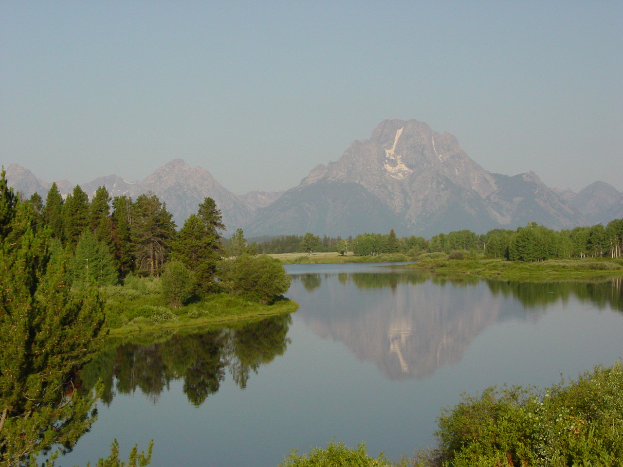
Federal agencies oversaw sizable portions of land in Wyoming. (In 2016, the federal government retained nearly 50 percent of all lands within the state of Wyoming). Some of the land had become part of the two national parks in Wyoming. Yellowstone National Park, the oldest in the national system, was formed in 1872. For more than a century, it remained the largest national park in the country. Grand Teton National Park, first formed in 1929, expanded in stages over the years with substantial additions made in 1953 when the so-called “Rockefeller gift” lands finally became part of the park.[xiii]
The federal government also retained lands in Wyoming for national defense, including “wood reservations” and a “naval petroleum reserve.” National forests make up a sizable piece of federally administered land in Wyoming.
The national parks, under the control of the National Park Service, were administered for preservation of the natural state, with allowances for conveniences to park visitors. National forests, on the other hand, were administered by the U. S. Forest Service, a branch of the U. S. Department of Agriculture. That agency’s mission was to conserve the resource—provide the greatest good to the most people for the longest period of time. The forests were essentially treated like crops.
In the 20th century, additional lands were set aside for national monuments, mostly administered by the National Park Service, and for reclamation districts under the control of the U. S. Bureau of Reclamation, but often opened for homesteading in 90-acre parcels.[xiv]
Many members of Congress from outside of the West considered the amount of land available to each homesteader to be quite generous. Westerners realized that much of the land still open to homesteading lacked sufficient prospects for success of even the most prudent farmer or rancher. Consequently, Western congressmen sponsored a series of land acts in the early 20th century designed to sweeten the prospects for homesteading. Wyoming’s member of Congress, Frank Mondell, sponsored the Enlarged Homestead Act in 1909 and managed to get the bill passed through Congress. The act doubled the homestead acres on which an individual could file and shortened the residence period on the land.
In 1916 Congress again made changes to the homesteading laws. In the Stock-raising Homestead Act of 1916, the Congress made it possible for ranchers (grazers) to “homestead” lands. No longer was it essential that the ground be plowed. In the act, each rancher/ homesteader could claim up to 640 acres (one section). There was no need to demonstrate successful crop agriculture on the tract, but the rancher gained only the surface rights. For the first time, Congress withheld passing the sub-surface (underground) rights to the eventual landowner. The result was a “split-estate” with the private owner controlling the surface and the federal government (or its lease-holder) able to control the sub-surface.[xv]
Initially, when the coal deposits in the Powder River Basin were not considered to be of substantial value, given that the coal was of a sub-bituminous variety—not like the better-quality coal along the Union Pacific line in southern Wyoming—there would be no worry about mining the sub-surface. That would change in the 1970s when the Arab oil embargo and the run-up in energy prices made the Basin’s coal an attractive fuel source.[xvi]
Homesteading reached its peak in Wyoming during the years immediately after World War I. The various homestead acts made this development possible, but advances in “dry farming” techniques as well as relatively mild weather and high crop prices brought about by World War I shortages, fueled the boom. When prices declined and weather continues changed, Wyoming homesteaders suffered severely. The federal government went out of the business of trying to give away or sell every acre of ground with the passage in 1935 of the Taylor Grazing Act. Except in isolated cases (reclamation districts and Alaska), the era of homesteading came to an end in Wyoming and the rest of America.[xvii]
The largest parcels of federally owned land in Wyoming are now administered by the Bureau of Land Management, successor agency to the “Bureau of Grazing” set up by the Taylor Act. Those lands, identified in the 1930s, were all of the lands remaining after other federal uses were carved out, the state had selected its various lands under the land grants from the federal government, and homesteaders had made their selections under the numerous acts. In a word, what remained were mostly marginal lands, useful only for animal grazing.[xviii]
In Wyoming, like much of the West, only a tiny percentage of ranchers had grazing access on these government lands. Costs for grazing were calculated on the basis of AUMs (animal unit month) or the amount of grazing that would feed a cow and calf for a month.
In essence, the wishes of those 1870s ranchers–who wanted to use the land for free, but have the federal government keep others off–won in the end. For at least the past half century, grazing lease costs have remained far below what ranchers would have to pay for grazing on private land or even on state land. This small minority thus holds significant competitive advantages over ranchers not having access to federal lands. At the same time, most of the anti-government screaming from the ranching community comes from those very moochers who complain bitterly about having to pay even the tiny amounts they are charged and whine about having to follow regulations that are generous, compared to what a private landowner would insist that they follow.
Unfortunately for the image of the rancher in the West, the national media prefers to focus on the whiners. They rarely consider the plight of the few remaining family ranches, now being overwhelmed by corporate operations and undercut by those five percent, the subsidized whiners grazing the public lands for almost nothing.(xix)
Because Congress recognizes principles of multiple use on BLM lands, what American taxpayers have lost to ranchers in subsidies on those lands has been regained, at least partially, in recent years, from mineral leasing. What were once viewed as “useless lands” are now the subject of mineral leasing auctions held often by the BLM. Yesterday’s useless lands also contributed substantially to the share the state of Wyoming received for many years from federal mineral leasing.[xx]
[i] Jefferson articulated his views favoring a nation of small farmers in the earliest day of the nation. For instance, during debates over the Virginia Constitution in 1776, he favored granting at least 50 acres of land to every person. See Dumas Malone. Jefferson the Virginian. (Boston: Little Brown and Co., 1948), p. 238.
[ii] Jefferson strongly favored even his own state of Virginia to turn over land claims further west, believing in the principle of an “expanding Union of self-governing commonwealths.” In the 1780s, he drew out boundaries for 14 additional states (when there were only 13 states in the Union) and gave names to ten of them. Dumas Malone, Jefferson the Virginian. (Boston: Little Brown and Co., 1948), pp. 412-13. On the other hand, Alexander Hamilton favored unlimited sale of public lands to buyers regardless of their intentions of future use. For the contrasting views of Jefferson and Hamilton on the public lands, see Jerry A. O’Callaghan, “Jefferson and Hamilton and the Public Lands,” in James Muhn, Harrison R. Stuart and Peter D. Doran. Opportunity and Challenge: The Story of BLM. (Washington: BLM, 1988), p. 7.
[iii] “Public Land Law Review Commission background,” Digest of Public Land Laws (Washington: Public Land Law Review Commission, June 1968), p. vii.
[iv] From 1849-1883, the meridian from which all longitude lines were drawn in the United States was the “American Meridian” passing along what is now 24th Street NW in Washington, D.C., passing through the center of what was then the dome of the U. S. Naval Observatory. Boundaries of western states, including the eastern boundary of Wyoming, were measured in round numbers from the American Meridian. The Wyoming boundary is exactly 27 degrees west of 24th Street. See David Alan Grier, “Attitude and Longitude,” Washington Post, Feb. 6, 2000.
[v] James Muhn, Harrison R. Stuart and Peter D. Doran. Opportunity and Challenge: The Story of BLM. (Washington: BLM, 1988), pp. 8-9.
[vi] For a thorough discussion of the various veterans’ land grant laws, see James W. Oberly. Sixty Million Acres: American Veterans and the Public Lands before the Civil War. (Kent State University Press, 1990).
[vii] Numerous anecdotal accounts tell of European immigrants deciding to locate in the United States rather than other countries in the Western Hemisphere because of the opportunity to homestead was not restricted to citizens. All they need do was to intend to become a United States citizen and they could file for a homestead.
[viii] Maury Klein, Union Pacific. Vol. 1: 1862-93. (Minneapolis: University of Minnesota Press, 1987), pp. 324-28.
[ix] Timber Culture Act, 17 Stat. 605c (1873).
[x] Opportunity and Challenge: The Story of BLM, pp. 25-26.
[xi] The attitude persists, even in the 21st century. See the various public land users’ stand-offs with the federal government in the American West. “Forty Years of Sagebrush Rebellion,” High Country News, http://www.hcn.org/articles/sagebrush-rebellion/ Accessed Jan. 4, 2016.
[xii] Digest of Public Land Laws, p. vii.
[xiii] Robert Righter. Crucible for Conservation: The Struggle for Grand Teton National Park. (Grand Teton Natural History Association, 2000).
[xiv] For an extensive overview of Bureau of Reclamation water projects, see Reclamation Project Data. (Washington: U. S. Dept. of the Interior, 1961). Projects are arranged alphabetically by river system.
[xv] Stock-raising Homestead Act, 39 Stat. 862 (1916).
[xvi] For the background of mineral leasing on federal lands in Wyoming, see Sam Western, The Mineral Leasing Act http://www.wyohistory.org/essays/mineral-leasing-act-1920
[xvii] For the current acreage administered by the Bureau of Land Management, see Public Land Statistics on the BLM website. http://www.blm.gov/public_land_statistics/index.htm
[xviii] Uninformed reading of the U. S. Constitution and utter ignorance of American history have led some misguided westerners to believe there is no federal ownership of land. A modicum of reading about the topic ought to disabuse them of these erroneous impressions.
[xix] During the presidential debates between candidates in 1980, I watched one of them in the home of a Western Wyoming rancher who grazed large numbers of cattle on public lands. He complained about how the incumbent President had done nothing to lower grazing fees on BLM lands. It was just “too much to pay,” he told me. I suggested that he move his cattle to private land or state lands. “Are you crazy?” he replied. “They are charging ten times what I’m paying for grazing now.” William A. J. Sparks would have shaken his head and probably smiled!
[xx] Of course, “multiple use” does not apply on land claimed from the public lands under the still-existing generous terms of the Mining Act of 1872. On those lands, private mining companies pay nothing for the gold, silver, copper and other precious metals they extract. Because Wyoming has relatively few precious metals deposits, it is largely irrelevant in this state. Nevada is the state most impacted by Mining Act operations.
Chronology of Land Laws
1862 (May 20)–Homestead Act passed.
1862 (July 1)–First Pacific Railway Act authorized the transcontinental railroad and granting government aid in the form of land grants. More acreage included in 1864.
1862 (July 2)–Morrill Act authorized grants of public lands to help establish and support designated state colleges as “land-grant” institutions drawing revenues from those lands given them by the federal government
1873–Timber Culture Act granted tracts of public lands to settlers who planted and cared for trees on the plains. Legislation encouraged reforestation as a means of conservation. Repealed in 1891.
1877–Desert Land Act authorized granting 640-acre tracts of arid public lands at $1.25 per acre to homesteaders who “brought water to the land.” Limited to 320 acres in 1891.
1890– Wyoming Admitted to Statehood and the federal government granted to the new state every section 16 and 36 in every township for public schools. Land also received to help pay for new State Capitol and other state institutions. Increased acreage to UW under Morrill Act (support for land-grant universities).
1916– Stock-raising Homestead Act increased acreage limitation for homesteading when public lands were suitable only for grazing livestock. Repealed in 1934. Documents for Public Lands:
Primary Documents: Public Lands
From “Report on the Lands of the Arid Region of the United States”
By John Wesley Powell (GPO, 1878).
PHYSICAL CHARACTERISTICS OF THE ARID REGION
The eastern portion of the United States is supplied with abundant rainfall for agricultural purposes, receiving the necessary amount from the evaporation of the Atlantic Ocean and the Gulf of Mexico; but westward the amount of aqueous precipitation diminishes in a general way until at last a region is reached where the climate is so arid that agriculture is not successful without irrigation. This Arid Region begins about midway in the Great Plains and extends across the Rocky Mountains to the Pacific Ocean….
…The limit of successful agriculture without irrigation has been set at 20 inches, that the extent of the Arid Region should by no means be exaggerated; but at 20 inches agriculture will not be uniformly successful from season to season. Many droughts will occur; many seasons in a long series will be fruitless; and it may be doubted whether, on the whole, agriculture will prove remunerative. On this point it is impossible to speak with certainty….
…Within the Arid Region only a small portion of the country is irrigable. These irrigable tracts are lowlands lying along the streams. On the mountains and high plateaus forests are found at elevations so great that frequent summer frosts forbid the cultivation of the soil…
…Small streams can be taken out and distributed by individual enterprise, but cooperative labor or aggregated capital must be employed in taking out the larger streams. The diversion of a large stream from its channel into a system of canals demands a large outlay of labor and material. To repay this all the waters so taken out must be used, and large tracts of land thus become dependent on a single canal. It is manifest that a farmer depending upon his own labor cannot undertake this task. To a great extent the small streams are already employed, and but a comparatively small portion of the irrigable lands can be thus redeemed; hence the chief future development of irrigation must come from the use of the larger streams….
The irrigable lands and timber lands constitute but a small fraction of the Arid Region. Between the lowlands on the one hand and the highlands on the other is found a great body of valley, mesa, hill, and low mountain lands. To what extent, and under what conditions can they be utilized? Usually they bear a scanty growth of grasses. These grasses are nutritious and valuable both for summer and winter pasturage. Their value depends upon peculiar climatic conditions; the grasses grow to a great extend in scattered bunches, and mature seeds in larger proportion perhaps than the grasses of the more humid regions. In general the winter aridity is so great that the grasses when touched by the frosts are not washed down by the rains and snows to decay on the moist soil, but stand firmly on the ground all winter long and “cure,” forming a quasi uncut hay. Thus the grass lands are of value both in summer and winter…
The men engaged in stock raising need small areas of irrigable lands for gardens and fields where agricultural products can be raised for their own consumption, and where a store of grain and hay may be raised for their herds when pressed by severe storms by which the country is sometimes visited…
The grass is so scanty that the herdsman must have a large area for the support of his stock. In general a quarter section of land alone is of no value to him; the pasturage it affords is entirely inadequate to the wants of a herd that the poorest man needs for his support. Four square miles may be considered as the minimum amount necessary for a pasturage farm, and a still greater amount is necessary for the larger part of the lands; that is, pasturage farms, to be any practicable value, must be of at least 2,560 acres, and in many districts they must be much larger.
Many a brook which runs but a short distance will afford sufficient water for a number of pasturage farms; but if the lands are surveyed in regular tracts as square miles or townships, all the water sufficient for a number of pasturage farms may fall entirely within one division. If the lands are thus surveyed, only the divisions having water will be taken, and the farmer obtaining title to such a division or farm could practically occupy all the country adjacent by owning the water necessary to its use. For this reason divisional surveys should conform to the topography, and be so made as to give the greatest number of water fronts…
Pasturage lands cannot be fenced. The great areas over which stock must roam to obtain subsistence usually prevents the practicability of fencing the lands. It will not pay to fence the pasturage fields, hence in many cases the land must be occupied by herds roaming in common; for poor men cooperative pasturage is necessary, or communal regulations for the occupancy of the ground and for the division of the increase of the herds….