Chapter 6: Building the Rails
Section 1: Choosing a Route and Financing Construction
Horses, oxen and other draft animals had been the transportation mainstays for eons. Then came railroads, transforming the society, culture, and economy of the United States. Railroads operated in Britain in the early 1800s. Soon, interest in steam locomotives and rails spread world-wide. With New York City prospering with the completion of the Erie Canal, Baltimore investors turned to the latest in technology to compete. In 1827, the Baltimore and Ohio company was chartered and, the following year, Baltimore businessmen, surveyors, and engineers set about building the B&O Railroad, laying the first commercial long-distance track and building the first passenger station. By 1840, railroad companies throughout the East had laid 3,328 miles of track, all of it east of the Mississippi River. By 1860, the trackage reached 28,000 miles.
Almost as soon as the first railway was completed in the U. S., pamphleteers argued for a transcontinental railroad. New York merchant Asa Whitney, having made and lost a fortune as an importer from Europe, took a long voyage to China in 1844. There, he became involved in the developing China trade, making a substantial fortune from shipping goods from Canton to Europe. On his return, he became more familiar with steam railroads and their increasing prevalence in America. He proposed building a transcontinental railroad, arguing that a coast-to-coast railroad would speed up the China trade, making it possible for American merchants to compete against Europeans for imports of Asian goods into Europe. In essence, the railroad would serve as a shipping short-cut for China goods bound for European customers.
It was in the time of Manifest Destiny and Whitney viewed his proposal as another means of making America the center of world commerce. He knew that private investors could never afford to take the risks and provide capital for such a project. Consequently, he asked his senator to introduce a bill in Congress seeking a 60-mile strip of land along which the railroad could be built, the excess lands sold off to finance the line’s construction. Congress tabled the measure, but for the next six years, Whitney continued to lobby for his plan. Tied up with debates over slavery and other sectional issues, Congress ultimately ignored Whitney’s proposals. In 1851, after Congress defeated his plan again, Whitney gave up, returning to private life. Defeated in his efforts to build a transcontinental railroad, he succeeded in getting such a proposal into the public discourse.[i]
Five years later (1856), civil engineer Theodore Judah headed the first construction of a railroad in California. During the building, Judah became convinced that in order for California to remain prosperous, it needed to be connected to the rest of the nation by railroad. In 1859, he traveled by sailing ship to lobby Congress on his idea. When he returned later that year, he organized a company and set out to find a route over the Sierra Nevada mountains, a major obstacle to eastern travel from California. He enlisted investments from four Sacramento businessmen—Collis Huntington, Charles Crocker, Mark Hopkins, and Leland Stanford—who would later become known as the “Big Four” when they became primary shareholders in the Judah venture.
Prior to Judah’s lobbying visits, Congress had debated the potential for a transcontinental railroad, but even as the idea gained popularity, politics intruded when it came to deciding where the route would run. It seemed that each member of Congress had a preferred route that would benefit his constituency. Consequently, in 1853, Congress decided to remove the location decision from politics by passing an act authorizing a series of Pacific Railway surveys. The surveys would be conducted by soldiers in the U. S. Army Corps of Topographical Engineers and, once the reports came back, Congressmen concluded they could make the route decision based on the route merits and not on mere politics.
As it turned out, these railway surveys, conducted in 1853, served as training grounds for future Civil War officers. Isaac Stevens, George McClellan, and John Pope were among the officers conducting the surveys. Secretary of War Jefferson Davis assigned the soldiers to investigate five routes: the Northern route (Lake Superior-Puget Sound). under the direction of Isaac Stevens, recently appointed territorial governor of Washington; the 38th-39th parallel route (St. Louis-West Coast) headed by Capt. John Gunnison (who was killed by Indians in western Colorado in June 1853. the expedition taken over by Lt. Edward G. Beckwith who completed the survey by following the 41st parallel, roughly along the same path that Capt. H. H. Stansbury and Gunnison had used in 1849 across what is now southern Wyoming); 35th parallel route (Little Rock-Los Angeles), commanded by Lt. A. W. Whipple. and the 32nd parallel route (favored by Jefferson Davis) and explored from the west by Lt. John Parke and from the East by Capt. John Pope.
When the surveyors reported back to Congress, each favored his own route. Further, each politician continued to favor the route benefiting his region. Jefferson Davis, formerly a senator from Mississippi (and later President of the Confederacy), wanted the southern route while Thomas Hart Benton of Missouri favored the route beginning in St. Louis. Congress continued to consider proposals for a railroad coast-to-coast, but nothing came of the plans. Congress and the rest of the nation were mired in sectional conflict and the debates over expansion of slavery that had divided the North and the South since the beginning of the century. Following President Abraham Lincoln’s election in 1860, southern states began to secede and the Civil War began.
With none of the members from the seceding states of the South remaining in the Congress and after strong lobbying from Theodore Judah, both the House and Senate passed a Pacific Railway Act in 1862. (The measure became the law about the same time as the Homestead Act, another measure that had been tied up due to Southern opposition). The Civil War both made it possible to pass the act and to locate the general route of the transcontinental railroad.
The first Pacific Railway Act contained several elements that Asa Whitney would have recognized. First, the federal government would grant a right-of-way, 400 feet wide, along which the track would be laid. Further, the railroad would receive a huge land grant. The federal government would provide every odd-numbered section ten miles either side of the tracks. Initially, some members of Congress thought the railroad should be given a ten-mile strip straight across the country along the right-of-way, but critics pointed out that with such a choke-hold on a solid swath of land would give the railroads substantial power. If the federal government were to retain every even-numbered section, it would be able to monitor the railroad and make sure it was not impeding settlement or exercising monopoly powers. (The result of this decision remains with Wyoming residents today as a later section on land will describe).
Additionally, the act offered bonds to be issued by the federal government, repayable to the federal government within 30 years with the government holding the first mortgage on the railroad to guarantee repayment. No minerals were included in the first act—the federal government kept all minerals except for “earth, stone, timber and other materials for the construction” in the 400-foot right-of-way. The act provided for $16,000 in bonds to be granted by the federal government for every mile of railroad construction. Recognizing that construction over the Rocky Mountains would require substantial outlays, the act allowed for double and triple that amount for the foothills and mountainous areas, hence $48,000 per mile to build through the mountains.
Two groups were very interested in the first Pacific Railway Act, but did not like many of its terms. They set about lobbying for changes almost immediately. The first, the “Big Four” (Stanford, Huntington, Crocker, and Hopkins), wanted to build west from California to the east, following Judah’s plan and surveys. A second group, organized by speculator Thomas Durant, sought the federal charter to build from the east to the west. The act spelled out how this second group would be organized—as a federally-chartered entity known as the Union Pacific Railroad Company. Unlike the “Big Four’s” Central Pacific Railroad, the Union Pacific, by virtue of its federal charter, included five federally-appointed directors on its board. The act also allowed a third company, the Leavenworth, Pawnee and Western Railroad, to begin building to the west on the same terms as the other two companies.
While the land grants seemed generous, several aspects of the first Pacific Railway Act caused few investors to race to put money into the enterprises. One, the law stipulated that the federal government retain first mortgage on all construction once bonding was authorized. The enterprise promised to be enormously difficult and if any of the companies failed, the investors would be standing in line behind the federal government for return of their investment. Further, the companies had no rights to minerals except for the immediate construction materials.
Company officials tried valiantly to gain shareholders and to sell the expensive bonds, but the initial offerings did not encourage investment from prudent investors. Consequently, the companies returned to lobby Congress for better terms in 1864. The result was passage of the Pacific Railway Act of 1864. Actually, a series of amendments to the first act, the 1864 law made investment in the railroads much more attractive. First, except for “precious metals” such as gold and silver, the railroads would receive rights to all minerals (except gold and silver), not only along the 400-foot right-of-way but underlying the “checkerboard sections”—those odd-numbered sections of land ten miles each side of the track. Further, the act extended the land grant to 20 miles each side of the track and made the federal government the second mortgage holder in event of default on the bonds.
Capt. Howard Stansbury’s expedition had pointed out the presence of coal in what is now western Wyoming in 1849. The new terms favored locating near these mineral lands—given that locomotives on the transcontinental line would be coal-fired.
The eastern beginning point for the railroad was determined by President Abraham Lincoln. A former trial lawyer. Lincoln had worked closely with railroad companies and learned a good deal about the needs of constructing lines prior to his election.[ii] He favored a place that he had visited—Council Bluffs, Iowa, and the relatively new town of Omaha, Nebraska, across the Missouri River.[iii]
Section 2: Building the Railroad Line
The entire history of the Union Pacific is beyond the scope of this brief account, but the railroad became the reason for the creation of Wyoming Territory.[iv] One key figure in the railroad was Grenville M. Dodge (1831-1916). Dodge served as a member of Congress from Iowa, a general in the Civil War, and most important for Wyoming, as chief engineer of the Union Pacific during the construction phase. In 1859, Dodge was sitting on the porch of the Pacific House hotel and Abraham Lincoln, a Springfield, Ill., lawyer in Council Bluffs, Iowa, to complete some legal work, engaged him in a lengthy conversation over western railroads.[v]
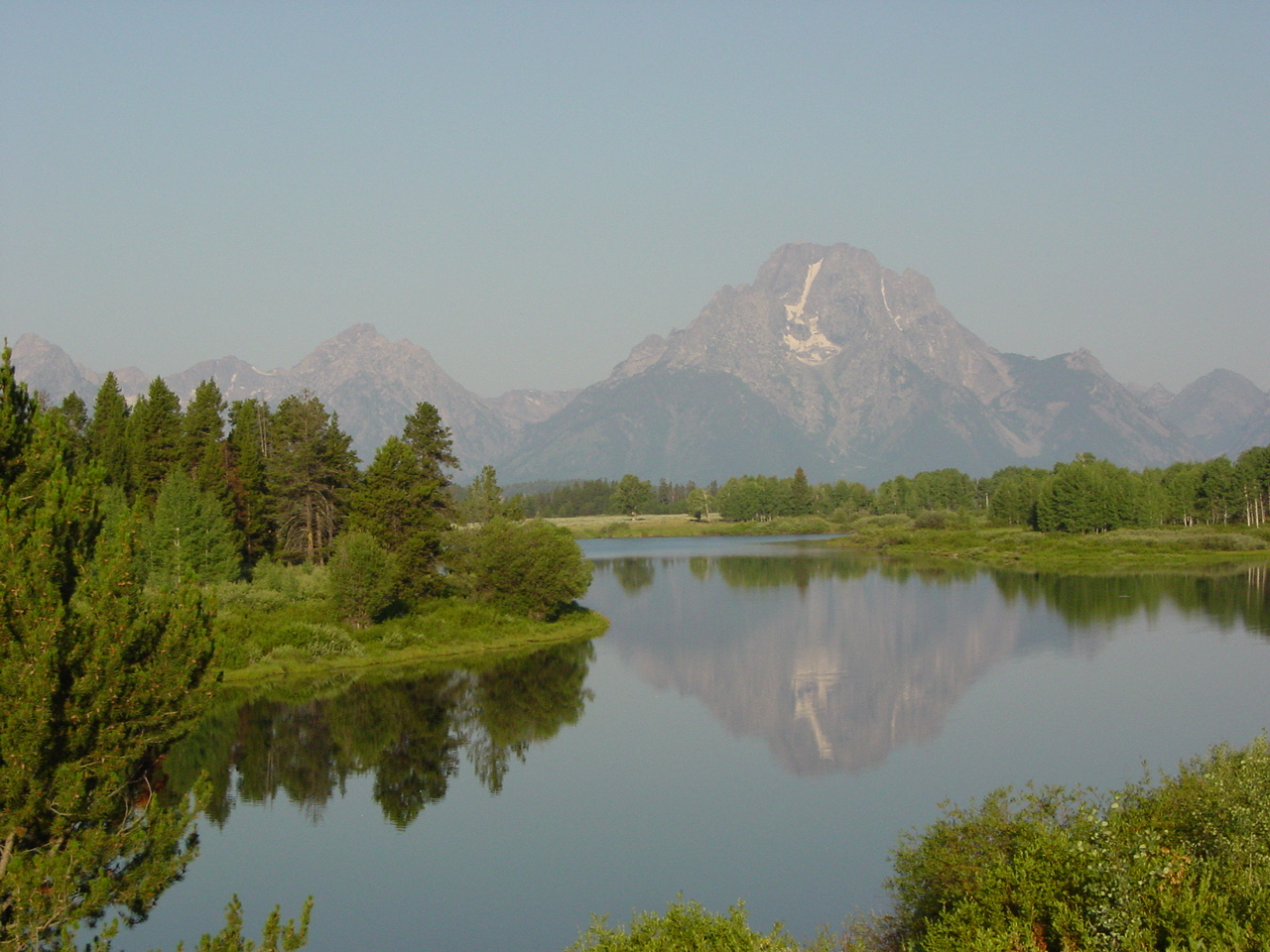
Dodge is credited with locating the route across most of Wyoming (Samuel Reed was in charge of the establishing the route from Green River to Salt Lake City). His most celebrated achievement, by most accounts, was finding “the gangplank”—a natural “bridge” over the Laramie Mountains (then called “the Black Hills”) lying between Cheyenne and Laramie. Dodge also located and laid out the town of Cheyenne in July 1867, and later determined the sites for Laramie and Rawlins as well as smaller towns across southern Wyoming. Each of these towns owe their locations, not particularly because of Dodge’s site selection but because Dodge chose the locations for the technological needs of railroad locomotives. Division points had to be located where trains could change crews, locomotives turned around to retrace the earlier route, and shops could be located to make essential repairs on very powerful, but mechanically fragile engines. For the steam-powered, coal-fired locomotives of the time, the points had to be about 100 miles apart. Because the route between Cheyenne and Laramie was so steep on each end crossing over the Laramie range, railroad engineers halved the distance to 50 miles. Thus, one could say that location of Wyoming towns along the UP line owe their presence to the limits of technology at the time.
Dodge, who wrote an account of his role in building the Union Pacific, worked closely with company officials, including Thomas Durant, the irascible company founder, and the Ames brothers. Heirs to a fortune made by selling shovels to miners and the Union Army during the Civil War, Oakes Ames (b. 1804) and his younger brother Oliver (b. 1807) were important investors in the Union Pacific. Further, Oliver Ames was Union Pacific Railroad president while his brother Oakes Ames served in the U. S. Congress, representing a district in Massachusetts.
The Financing
The Ames brothers, Durant, and others were responsible for setting up a company they called Credit Mobilier that would handle the actual construction of the railroad. It was a separate company from the Union Pacific. The UP would operate the rolling stock once the line was finished and contract with the builders for the job. Through various maneuvers, Credit Mobilier billed the UP for construction work, the UP submitted the bills to Congress to demonstrate they needed additional bonding funds, and Congress obligingly authorized payment. The Ames’ were on all three corners—Oakes in Congress, Oliver as UP President, and both on the Credit Mobilier board. To ensure that the arrangement would continue, the founders gave or sold stock cheaply to members of Congress and other influential people.
After the railroad was completed, political and business opponents of the Ames brothers claimed that Credit Mobilier investors had received millions from cost overruns and improper billing. The claim was that cost overruns may have run as high as $13-16 million over the real costs of construction.[vi]In 1872, after the railroad was completed, the Credit Mobilier scandal rocked Congress and the financial community. Oakes Ames, probably innocent of wrong-doing in the operations, nonetheless was censured and forced to retire from Congress while his brother also was disgraced. Both men died soon after the scandal, Oakes in 1873 and Oliver in 1877. Thomas Durant, a prime organizer of the financial scheming surrounding the railroad’s organization, managed to avoid punishment for irregularities in the railroad’s construction and financing.[vii]
In the decade after the Ames’ deaths, family and friends helped finance a memorial to the two brothers to recognize their role in building the first transcontinental railroad. They hired H. H. Richardson, the foremost architect of his day. The result was the Ames Monument, a 60-foot pyramid built on the highest point of the railroad, on the summit between Cheyenne and Laramie.[viii] It remains an unusual landmark, silent and isolated, no longer noticed by travelers because it is beyond the view of most Interstate 80 traffic.[ix]
The Construction
Once the Civil War ended, railroad construction began in eastern Nebraska.
Meanwhile, 500 miles to the west, survey crews led by Grenville Dodge, James Evans, and Samuel Reed, were weighing the options to cross the Rockies.
One route seemed obvious at first—the Oregon-California-Mormon Trail route through central Wyoming, over South Pass and southwest to Utah. Surveyors, however, thought there were greater benefits to the “Overland Trail” route—used by Ben Holladay’s stage line. The distance was shorter by more than 60 miles and, important to fueling a future railroad, the more southern route lay close to known coal beds. Further, federal bonds would triple in amount once the “mountainous area” was reached. That would happen some 200 miles closer at the “Black Hills” (Laramie Range) on the southern route than where they began along the Oregon-California Trail route, near South Pass.
Yet for all of its value as the starting point for higher bonds, a critical obstacle for track layers remained—the “Black Hills” (Laramie Range) west of Cheyenne. Once Dodge discovered “the gangplank” and demonstrated how Dale Creek Canyon could be traversed by a trestle, the Overland Trail route gained the advantage. By the summer of 1867, the Union Pacific survey crews had staked out much of the line across Wyoming, ensuring that the ground was sufficiently level for locomotives unable to handle steep grades. Even four percent was excessive (four feet increase in every 100 feet rise in elevation), explaining why the route passed in a long loop to the north of Elk Mountain and the Snowy Range, a major deviation from the stagecoach line that followed more closely today’s Interstate 80 route in that area.
Surveyors came first, followed by graders who prepared a relatively level surface with gentle level slopes on which to lay the rails. Tie-layers and tie hacks (the latter working far away from the tracks, cutting down trees, fashioning them into ties and often floating them down to the existing tracks) were next in line. Then came the track-layers who placed the rails on the ties and spiked them down. Then, it was time for the locomotives and train operators as well as builders of shops, water towers, and housing for permanent workers.
Some 5,000 men worked on the Union Pacific in the various capacities. None were ever located at the same point along the railroad line. Nonetheless, thousands more people congregated just ahead of the “end-of-tracks” in places that became known as “hell-on-wheels” towns. Seeking to take advantage of railroad builders’ thirsts for liquor, gambling, and women, business operators in these towns expected to make fast money at one location and then, when the tracks continued building west, move quickly to the next designated townsite up the line and set up business there.
On the Fourth of July, 1867, Grenville Dodge camped at the future site of Cheyenne. A few days later, he and his survey crew laid out what would become a division point on the railroad and Wyoming’s capital, some 500 rail miles from Omaha, the railroad’s eastern terminus. As a division point, the town, unlike most “hell-on-wheels” towns, would have some permanence. The town grew rapidly in less than two months. Nicknamed “the Magic City of the Plains” due to the phenomenal grown, Cheyenne already had a post office, a newspaper, several professional offices, numerous saloons and other gaming houses by the time the tracks were built through town in September, 1867.[x]
West of Cheyenne, however, was one of the biggest challenges for the UP, the 8,242-foot summit of the mountains and, just west of it, Dale Creek Canyon. The gangplank solved problems with the steep grade on the eastern flank of the hills, but the canyon required more work. Track-laying crews waited in Cheyenne while Dale Creek Trestle was built during the winter of 1867-68. Some 700 feet long and 127 feet high, it was the highest railroad bridge in the world at the time. The initial trestle was built of wood, almost entirely imported by rail from the Midwest.
The pause did not affect surveyors laying out the route west, graders working on rights-of-way, or tie hacks supplying railroad ties from the forests west of Laramie, but the work delays for the track layers led to winter months in Cheyenne where boredom and excess leisure time led to fights, excessive drinking, gambling, gunplay and, eventually, to vigilante justice. To bring safety to all in the new town, during the first month of organized city government, the town council passed a law controlling firearms–making it illegal for anyone but law officers to carry, openly or concealed, any firearm in the city limits of Cheyenne. Other towns adopted similar ordinances that were enforced and remained in effect well into the 20th cenury. (See Document 3, right column on this page). This gun control was not challenged constitutionally and, in fact, universally welcomed except by lawless elements who would be “invited” to leave town if they didn’t want to obey the law.
The several months of business activity helped cement Cheyenne’s permanence. By the time the bridge was completed in April 1868 and the track-laying crews had reached the new town of Laramie (just a mile to the north of Fort Sanders, founded a couple of years earlier to garrison soldiers protecting the Overland stage route), Cheyenne merchants were putting up wooden and brick buildings to replace the tent-like structures universally preferred in the early months. Near Cheyenne, the army built Fort D. A. Russell (later renamed Fort Warren and, today, Warren Air Force Base) as protection for the railroad. It was one of several such forts built as yet more federal subsidies for the railroad—free protection for its workers.
Dodge located the townsite for Laramie on the Union Pacific checkerboard section that was located roughly from where the railroad tracks currently run through town, east to 15th Street and from present Spring Creek to Fremont Street. Other parts of Laramie were on the checkerboard sections retained by the federal government and later homesteaded or kept, until the end of the 19th century, as part of Fort Sanders Military Reservation (south of present Laramie, near the present site of the Cavalryman) or the territorial prison (now the Wyoming Territorial Park).
Rails reached Laramie in early May 1868. Although the exact date is disputed, the record suggests that the first train carrying passengers pulled into the newly established town on May 6, 1868—just one year and four days before the entire line was completed across the continent.
Just as in the case of Cheyenne and several other Wyoming towns, a newspaper was published at “Fort Sanders” and “Laramie” just as the town was formed. It was the Frontier Index, the third newspaper published in Wyoming. (The post telegrapher published a newspaper at Fort Bridger in 1863 known as the Daily Telegraph and an earlier paper was published by soldiers at Fort Laramie called “The Chugg Water Journal,” although it was more of a newsletter in style). Legh Freeman, the Frontier Index publisher, was a former “galvanized Yankee” who loaded his printing equipment onto the first train to an “end-of-tracks” town, set it up, and began publishing until the tracks moved further down the line. The Frontier Index came to an ignominious end at Bear River City later the following year when Freeman wrote a scathing critique of vigilantism. He was run out of town, his “tent” destroyed and his press thrown in the nearby river.[xi]
Like many of the other towns established by the railroad, Laramie suffered initially from a lack of law and order. In fact, M. C. Brown, the first mayor of Laramie, resigned after three weeks, complaining about the incompetence of other local officials and declaring that the town itself was “ungovernable.”[xii] Through a series of lynchings, vigilantes steadily retook control of the lawless element in the town, hanging four men and running most of their fellow outlaws out of town.[xiii]
Laramie’s lawlessness was not unique. Throughout the area, there was a total absence of territorial government. Just the previous year (1867), Congress separated what is now Wyoming from Dakota Territory. The new territory existed only on the books. Because Congress established territory at the time President Andrew Johnson was being impeached, Congress did not wish him to appoint the territorial officers. Consequently, the positions remained vacant and the territorial was unorganized until after President U. S. Grant became President in the spring of 1869, two months before the railroad was completed across the west.[xiv]
After laying rails over the summit, named “Sherman Hill” in honor of General William T. Sherman, the U. S. Army commander and friend of Grenville Dodge, the rest of the track-laying across southern Wyoming was relatively easy. The rest, too, for the railroad, was very profitable because they were being paid in “triple bonds” as though the mostly flat, treeless plains were “mountainous” the entire way to the Utah border. And, of course, with the minerals rights to all checkerboard lands, the railroad profited for many years to come from the land grant of odd-numbered sections 20 miles north and 20 miles south of the tracks.
Meanwhile, threats of Indian attacks lessened along the southern route, particularly after the federal government met with Lakota and other tribes and agreed to close down the Bozeman Trail in exchange for the Indians allowing railroad construction to the south. The Shoshones to the west signed the second Fort Bridger Treaty in 1868, through which the federal government seemed to be reasserting the tribes’ claims to vast stretches of what is now western Wyoming. The first treaty, the Fort Bridger Treaty of 1864, granted even greater land area to the tribe.
Not only was the railroad, led by Grenville Dodge and the other surveyors, responsible for laying out many other towns, surveyors also gained the privilege of naming them. Dodge named Rawlins for his friend and fellow Civil War general, John A. Rawlins. Evanston was named for fellow surveyor James Evans.[xv] Dodge took it a step further in Cheyenne by laying out the streets, to run parallel to the UP tracks through town, and naming them for members of his survey crew. Many of those street names remain today (although Ferguson Street is now Carey Avenue, Ransom was renamed Central, Hill Street became Capitol Avenue, and even Dodge was renamed, becoming Warren Avenue).[xvi]
After initial difficulties with previous landowners along the river, the railroad eventually laid out Green River where the railroad constructed a bridge over the river by the same name. There were coal mines opened at points along the line where the fuel could be mined and supplied to the coal-fired steam locomotives—places like Carbon and Rock Springs.[xvii] And there were many more. Some, like Benton, Bryan, and Bear River City, were temporary towns where speculators bought and sold building lots for hundreds of dollars only to discover later that the railroad had no plans to include rail facilities at the site. As quickly as they grew, they disappeared into where they had begun—dust and sagebrush.[xviii]
A few smaller places did have utility for the railroad. They could be fuel-loading stops or places where cattle could be loaded onto livestock cars for shipment to market. Some other “towns” were little more than water stops where the railroad built water towers for the steam locomotives that required refilling every 50 or so miles.
The tracklayers, working six days a week from dawn to dusk and who had hammered “ten spikes per rail,” and had laid “400 rails per mile,” finally finished at Promontory Point, Utah, on May 10, 1869. There, the Union Pacific line met the Central Pacific (the line of the “Big Four” and Theodore Judah) that had been built from California to the east.
The nation celebrated what some people believed was the greatest engineering achievement of the age and the country was united by rails for the first time. But the impact of the railroad on Wyoming was even more profound. Without it, there would have been no need for Wyoming Territory—or for the state that followed in 1890, some 30 years after rails passed through an almost empty territory.
[i]Whitney’s memorial to Congress is an appendix to his book advocating for a railroad. See: Asa Whitney. A Project for a Railroad to the Pacific. (New York: George W. Wood, 1849).
[ii] For a recent overview of Lincoln’s legal career, see Brian Dirck. Lincoln the Lawyer. (Urbana: University of Illinois Press, 2009). As Dirck writes of his early career: “Few people were as enthusiastic about railroads as Lincoln.” (p. 91)
[iii] Lincoln, a veteran of the Black Hawk War, used his soldiers’ script to claim property in Iowa. The first parcel Lincoln received was 40 acres in Howard Township in Tama County and the second was 120 acres in Crawford County. http://www.abrahamlincolnonline.org/lincoln/sites/iowaland.htm See also: Oliver Fraysee. Lincoln, Land and Labor, 1809-60. (Urbana: University of Illinois Press, 1994), p. 196. Other sources indicated that he also obtained, through legal fees, several town lots in the city of Council Bluffs. “Lincoln and O. M. Hatch, Illinois Secretary of State, left Springfield on August 9, 1859, for Council Bluffs. Lincoln planned to look over property being offered by Norman B. Judd as security for a $3,000 debt. While in town, Lincoln found railroad civil engineer, Grenville M. Dodge, relaxing on the porch of the Pacific House. Having been told by Pusey that Dodge had been looking for a practical rail route to the Pacific Ocean, Lincoln skillfully questioned Dodge for two hours.Years later, Dodge wrote: “This interview was of the greatest importance to me. It was a milestone in my life and Lincoln never forgot it.”
[iv] See, for instance, David H. Bain. Empire Express: Building the First Transcontinental Railroad. (New York: Penguin, 2000). More particular to the Union Pacific and more detailed, particularly as to the financing of the road, is: Maury Klein. Union Pacific. 2 vol. (Minneapolis: University of Minnesota Press, 2006). Also of interest, albeit with some serious factual flaws is: Stephen Ambrose. Nothing Like It in the World: The Men Who Build the Transcontinental Railroad, 1863-69. (New York: Simon and Schuster, 2000).
[v] See also Dodge’s recollections in, How We Built the Union Pacific Railway. (Washington, D.C.: GPO, 1910).
[vi]Robert W. Fogel, The Union Pacific Railroad. (Baltimore: Johns Hopkins Press, 1960), pp. 66-71. Murray Klein estimated that the cost of the construction was about $16 million, but compensation paid by the federal government amounted to some $60 million. Klein, Union Pacific, p.
[vii] The Central Pacific had its own similar construction set-up with a firm known as the Contract and Finance Company. It operated like Credit Mobilier, rewarding insiders with huge profits largely from federal government-provided funds. For a thorough overview of the massive fraud and corruption among the individuals operating the railroad companies at the time, see Richard White. Railroaded: The Transcontinentals and the Making of Modern America. (New York: W. W. Norton, 2012). For a contemporary condemnation of the Credit Mobilier owners, see Edward Winslow Martin, Behind the Scenes in Washington. (Continental Publishing Co., 1873), Chap. VIII: The Credit Mobilier.
[viii] Now a state historic site, for a well-researched earlier history, see H. R. Dietrich, “The Architecture of H. H. Richardson: A New Look at the Ames Monument,” 38 Annals of Wyoming (April 1966), 49-53.
[ix] For specifics about the monument, see SHPO’s website entry for it: http://wyoparks.state.wy.us/Site/SiteInfo.aspx?siteID=16
[x]Cheyenne is unusual in that a “history” of the town was published before it had been in existence even a year! E. H. Saltiel and George Barnett. History and Business Directory of Cheyenne and Guide to the Mining Regions of the Rocky Mountains. (Cheyenne, privately printed, 1868; republished by Yale University Library, 1975).
[xi] The standard biography is: Thomas Hueterman, Movable Type: Biography of Legh Freeman. (Ames: Iowa State University Press, 1979).
[xii] Kim Viner. Melville C. Brown: Frontier Lawyer and Jurist. (Laramie, Wyo.: Kim Viner, 2015). See also: http://www.wyohistory.org/encyclopedia/wyoming-lawyer-melville-c-brown-man-his-time
[xiii] J. H. Triggs. History and Directory of Laramie City. (Laramie: Daily Sentinel Printing, 1875).
[xiv] For a concise account of railroad construction from Cheyenne to Laramie and the early history of Laramie, see T. A. Larson, History of Wyoming (Lincoln: University of Nebraska Press, 1965, 1989), chap. 3.
[xv] For a dated, but still useful history of Evanston and vicinity, see Elizabeth Arnold Stone. Uinta County: Its Place in History. (Laramie: Laramie Printing Co., 1924).
[xvi] For an early downtown Cheyenne street map and essays on important residences built in the city during the territorial period, see Laramie County Historical Society. Early Cheyenne Homes, 1880-90. (Cheyenne, 1962).
[xvii] For the railroad’s official history of their coal operations, see Union Pacific PR Dept., History of the Union Pacific Coal Mines, 1868-1940. (Omaha: Colonial Press, 1940).
[xviii] J. H. Beadle. The Undeveloped West, or, Five years in the territories: being a complete history of that vast region between the Mississippi and the Pacific, its resources, climate, inhabitants, natural curiosities, etc., etc. Life and adventure on prairies, mountains, and the Pacific coast. With two hundred and forty illustrations, from original sketches and photographic views of the scenery, cities, lands, mines, people, and curiosities of the great West. (Philadelphia: National Publishing Co., 1873).
Document 1: Pacific Railway Act, July 1, 1862
(12 U. S. Statutes, p. 489 ff.)
An Act to aid in the Construction of a Railroad and Telegraph Line from the Missouri River to the Pacific Ocean. . . .
Be it enacted, That [names of corporators]; together with five commissioners to be appointed by the Secretary of the Interior… are hereby created and erected into a body corporate… by the name… of “The Union Pacific Railroad Company”… ; and the said corporation is hereby authorized and empowered to lay out, locate, construct, furnish, maintain and enjoy a continuous railroad and telegraph… from a point on the one hundredth meridian of longitude west from Greenwich, between the south margin of the valley of the Republican River and the north margin of the valley of the Platte River, to the western boundary of Nevada Territory, upon the route and terms hereinafter provided…
Sec. 2. That the right of way through the public lands be… granted to said company for the construction of said railroad and telegraph line; and the right… is hereby given to said company to take from the public lands adjacent to the line of said road, earth, stone, timber, and other materials for the construction thereof; said right of way is granted to said railroad to the extent of two hundred feet in width on each side of said railroad when it may pass over the public lands, including all necessary grounds, for stations, buildings, workshops, and depots, machine shops, switches, side tracks, turn tables, and water stations. The United States shall extinguish as rapidly as may be the Indian titles to all lands falling under the operation of this act…
Sec. 3. That there be… granted to the said company, for the purpose of aiding in the construction of said railroad and telegraph line, and to secure the safe and speedy transportation of mails, troops, munitions of war, and public stores thereon, every alternate section of public land, designated by odd numbers, to the amount of five alternate sections per mile on each side of said railroad, on the line thereof, and within the limits of ten miles on each side of said road… Provided That all mineral lands shall be excepted from the operation of this act; but where the same shall contain timber, the timber thereon is hereby granted to said company…
Sec. 5. That for the purposes herein mentioned the Secretary of the Treasury shall… in accordance with the provisions of this act, issue to said company bonds of the United States of one thousand dollars each, payable in thirty years after date, paying six per centum per annum interest… to the amount of sixteen of said bonds per mile for each section of forty miles; and to secure the repayment to the United States… of the amount of said bonds… the issue of said bonds… shall ipso facto constitute a first mortgage on the whole line of the railroad and telegraph…
Sec. 9. That the Leavenworth, Pawnee and Western Railroad Company of Kansas are hereby authorized to construct a railroad and telegraph line… upon the same terms and conditions in all respects as are provided [for construction of the Union Pacific Railroad]…. The Central Pacific Railroad Company of California are hereby authorized to construct a railroad and telegraph line from the Pacific coast… to the eastern boundaries of California, upon the same terms and conditions in all respects [as are provided for the Union Pacific Railroad].
Sec. 10 …And the Central Pacific Railroad Company of California after completing its road across said State, is authorized to continue the construction of said railroad and telegraph through the Territories of the United States to the Missouri River… upon the terms and conditions provided in this act in relation to the Union Pacific Railroad Company, until said roads shall meet and connect…
Sec. 11. That for three hundred miles of said road most mountainous and difficult of construction, to wit: one hundred and fifty miles westerly from the eastern base of the Rocky Mountains, and one hundred and fifty miles eastwardly from the western base of the Sierra Nevada mountains… the bonds to be issued to aid in the construction thereof shall be treble the number per mile hereinbefore provided… and between the sections last named of one hundred and fifty miles each, the bonds to be issued to aid in the construction thereof shall be double the number per mile first mentioned…
Document 2: Pacific Railway Act, July 2, 1864.
(13 U. S. Statutes, p. 356 ff.)
The second Pacific Railway Act actually consisted of amendments to the first act, making the terms more attractive to possible builders of the government-subsidized tracks across the West. Important to Wyoming history were provisions increasing the amount of land the federal government gave to the railroad from every odd-numbered section ten miles on either side of the tracks to double that amount. Also, the railroad companies were granted rights to the minerals underlying those lands, making it possible for the Union Pacific Railroad company in the 20th century to off-set losses in freight-hauling with royalties earned from minerals produced from these land-grant sections. Other provisions sweetened the deal for bond-purchasers by readjusting the order of payment in the event the company failed.
AN ACT to amend an act entitled “An act to aid in the construction of a railroad and telegraph line from the Missouri river to the Pacific ocean, and to secure to the government the use of the same for postal, military, and other purposes,” approved July first, eighteen hundred and sixty-two.
Be it enacted by the Senate and House of Representatives of the United States of America in Congress assembled,
That the capital stock of the company entitled the Union Pacific Railroad Company, authorized by the act of which this act is amendatory, shall be in shares of $100, instead of $1,000, each; that the number of shares shall be one million, instead of one hundred thousand; and that the number of shares which any person shall hold to entitle him to serve as a director in said company (except the five directors to be appointed by government) shall be fifty shares, instead of five shares…
SEC. 2. Authorized $100 million in capital the UP was allowed to be raised, but never in excess of the cost of the railroad construction; established general office in New York City, but allowed for stock sales in other cities.
SEC. 3. And be it further enacted, That the Union Pacific Railroad Company, and all other companies provided for in this act and the act to which this is an amendment, be, and hereby are empowered to enter upon, purchase, take, and bold any lands or premises that may be necessary and proper for the construction and working of said road, not exceeding in width one hundred feet on each side of its centre line, unless a greater width be required for the purpose of excavation or embankment; and also my lands or premises that may be necessary and proper for turnouts standing places for cars, depots, station house[s], or any other structures required in the construction and operating of said road. And each of said companies shall have the right to cut and remove trees and other materials that might by falling encumber its road-bed, though standing or being more than one hundred feet therefrom.
SEC. 4.[Increased the land grant to 20 miles on each side of the road. Defined “mineral lands,” where ever the same occurs in this act, and the act to which this is an amendment, shall not be construed to include only coal and iron land].
“[The land grant]shall not defeat or impair any pre-emption, homestead, swamp-land, or other lawful claim, nor include any government reservation or mineral lands, or the improvements of any bona fide settler on in any lands returned and denominated as mineral lands, and the timber necessary to support his said improvements is a miner or agriculturalist, to be ascertained under such rules as have been or may be established by the Commissioner of the General Land Office, in conformity with the provisions of the pre-emption laws: [Subject also to lands located under act for benefit of colleges agriculture, and the arts–the Morrill Act, passed July 2, 1862, granting federal land for colleges]…”
SEC. 5. [Time extended one year for designating route, filing map, and completing road].
SEC. 6.[President may appoint commissioners at any time].
SEC. 7. And be it further enacted, That so much of section seventeen of said act as provides for a reservation by the government of a portion of the bonds to be issued to aid in the construction of the said railroads is hereby repealed. And the failure of any one company to comply fully with the conditions and requirements of this act, or the act to which this is amendatory, shall not work a forfeiture of the rights, privileges, or franchise of any other company or companies that shall have complied with the same.
SEC. 8. And be it further enacted, [Provision allowed for Union Pacific Railroad to be paid a proportion of government bonds for building in the mountains before final completion of the road].
SEC. 9. And, be it further enacted, That to enable any one of said corporations to make convenient and necessary connections with other roads, it is hereby authorized to establish and maintain all necessary ferries upon and across the Missouri river, and other rivers which its road may pass in its course; and authority is hereby given said corporation to construct bridges over said Missouri river and all other rivers for the convenience of said road…
SEC. 10. And be it further enacted, That section five of said act be so modified and amended that the Union Pacific Railroad Company, the Central Pacific Railroad Company, and any other company authorized to participate in the construction of said road, may, on the completing of each section of said road, as provided in this act, and the act to which this act is an amendment, issue their first mortgage bonds on their respective railroad and telegraph lines to an amount not exceeding the amount of the bonds of the United States, and of even tenor and date, time of maturity, rate and character of interest, with the bonds authorized to be issued to said railroad companies respectively. And the lieu of the United States bonds shalt be subordinate to that of the bonds of any or either of said companies hereby authorized to be issued on their respective roads, property, and equipments, except as to the provisions of the sixth section of the act to which this act is an amendment, relating to the transmission of dispatches and the transportation of mails, troops, munitions of war, supplies, and public stores for the government of the United States…
SEC. 11.Outstanding bonds already issued by any road shall be deducted from the amount of the bonds to be issued by the government…
SEC. 12. And be it further enacted, The Union Pacific R.R. Co., Eastern Div. shall build branch from Leavenworth to Lawrence in 2 years….
SEC. 13.And be it further enacted, That at and after the next election of directors, the number of directors to be elected by the stockholders shall be fifteen; and the number of directors to be appointed by the President shall be five; and the President shall appoint three additional directors to serve until the next regular election, and thereafter five directors…. The government directors, shall, from time to time, report to the Secretary of the Interior, in answer to any inquiries be may make of them, touching the condition, management, and progress of the work, and shall communicate to the Secretary of the Interior, at any time, such information, as should be in the possession of the Department. They shall, as often as may be necessary to a full knowledge of the condition and management of the line, visit all portions of the line of road, whether built or surveyed; and while absent from home, attending to their duties as directors, shall be paid their actual travelling expenses, and be allowed and paid such reasonable compensation for their time actually employed as the board of directors may decide.
SEC. 14. And be it further enacted. [The directors shall hold office for one year] and all subsequent regular elections shall be held annually thereafter at the same place; and the directors shall hold their offices for one year, and until their successors are qualified.
SEC. 15. And be it further enacted, That the several companies authorized to construct the aforesaid roads are hereby required to operate and use said roads and telegraph for all purposes of communication, travel, and transportation, so far as the public and the government are concerned, as one continuous line; and in such operation and use, to afford and secure to each equal advantages and facilities as to rates, time, and transportation, without any discrimination of any kind in favor of the road or business of any or either of said companies, or adverse to the road or business of any or either of the others; and it shall not be lawful for the proprietors of any line of telegraph authorized by this act, or the act amended by this act, to refuse or fail to convey for all persons requiring the transmission of news and messages of like character, on pain of forfeiting to the person injured, for each offence, the sum of one hundred dollars, and such other damages as he may have suffered on account of said refusal or failure, to be sued for and recovered in any court of the United States, or of any state or territory of competent jurisdiction.
SEC. 16. And be it further enacted It is further provided, that, should the Central Pacific Railroad Company of California complete their line to the eastern line of the State of California before the line of the Union Pacific Railroad Company shall have been extended westward so as to meet the line of said first named company, said first-named company may extend their line of road eastward one hundred and fifty miles on the established route, so as to meet and connect with the line of the Union Pacific Railroad, complying in all respects with the provisions and restrictions of this act as to said Union Pacific road, and upon doing so shall enjoy all the rights, privileges, and benefits conferred by this act on said Union Pacific Railroad Company.
SEC. 17. [Iowa and Minnesota companies may build the Sioux City branch. Union Pacific released from the construction of this branch. Provision in case of default of the Iowa and Minnesota companies].
SEC. 18. And be it further enacted, That the Burlington and Missouri River Railroad Company, a corporation organized under and by virtue of the laws of the State of Iowa, [authorized to extend its line and connect with main line] ….
SEC. 22. And be it further enacted, That Congress may at any time alter, amend, or repeal this act.
Approved July 2, 1864.